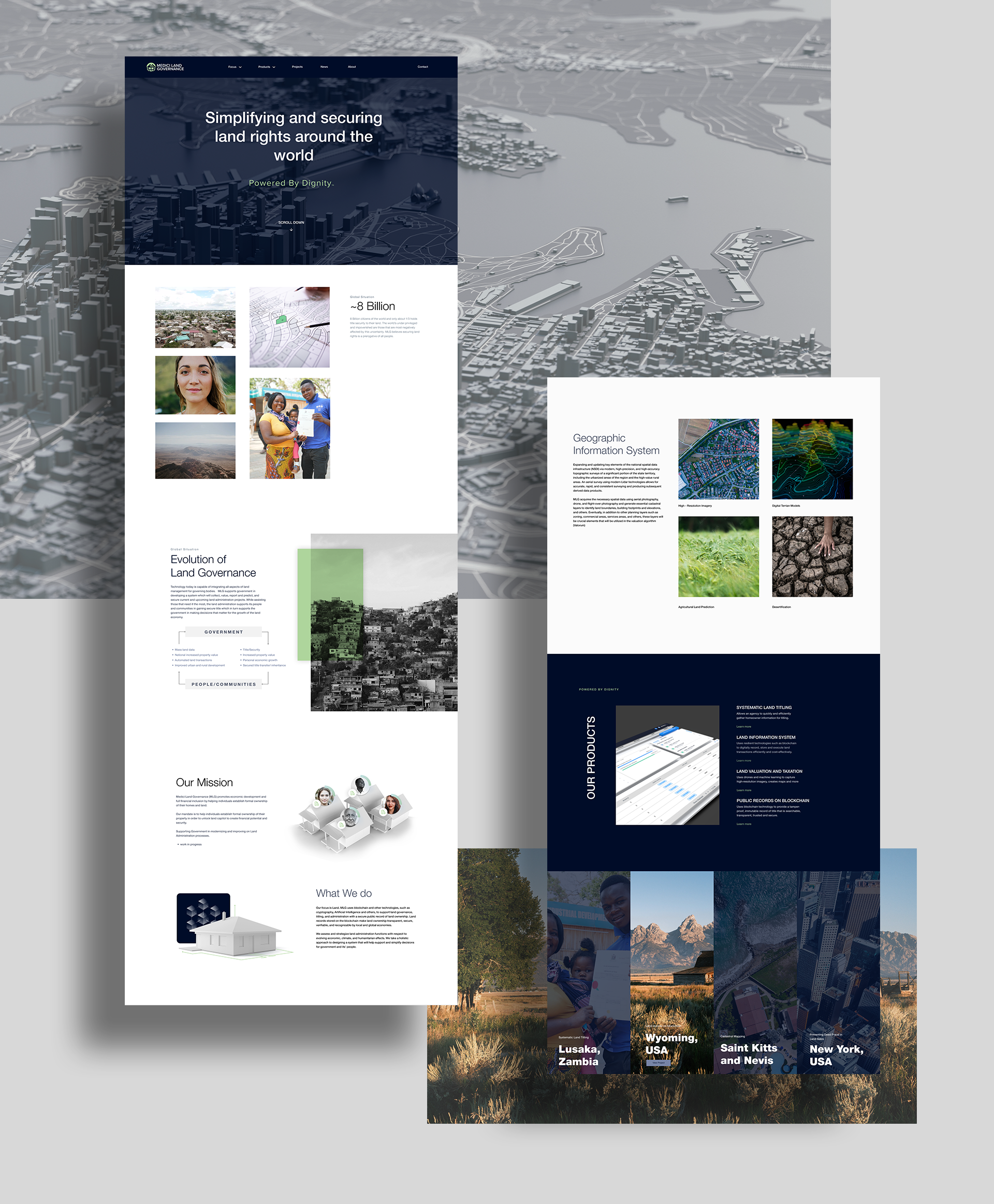
Medici Land Governance
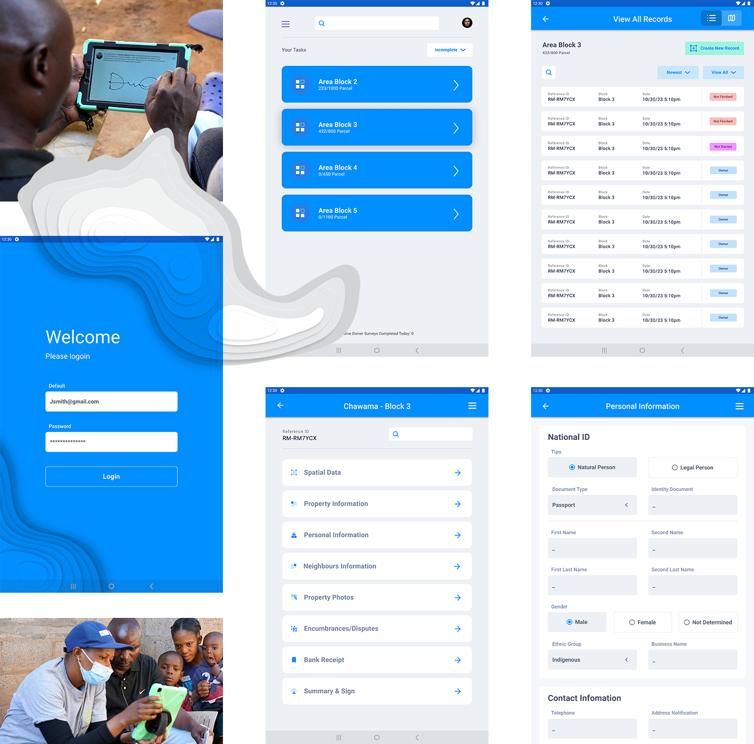
MLG's digital land-titling product is a one-and-done solution. Once work has been completed on an area, DLT does NOT provide an efficient way to view or progress records/parcels that are incomplete or ineligible. MLG leverages blockchain and other technologies to provide user-friendly, low-cost land administration systems.
Services:
- Branding Indentity
- Brand Architecture
- Website Creation/Development
- Marketing Assets
- Product Strategy(UX) & Design(UI)
- Product Documentation (marketing)
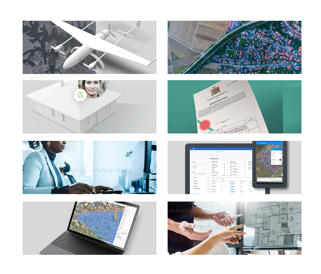
BRANDING


Website

UX \ UI
The Ask
The mission statement at Medici is to empower land-owners globally and provide a worldwide consistent, digital land-titling system.
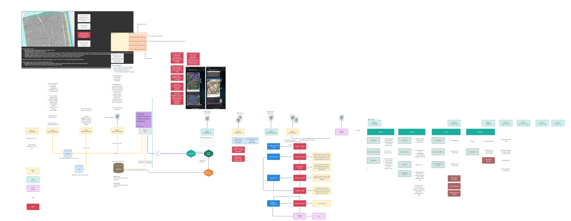
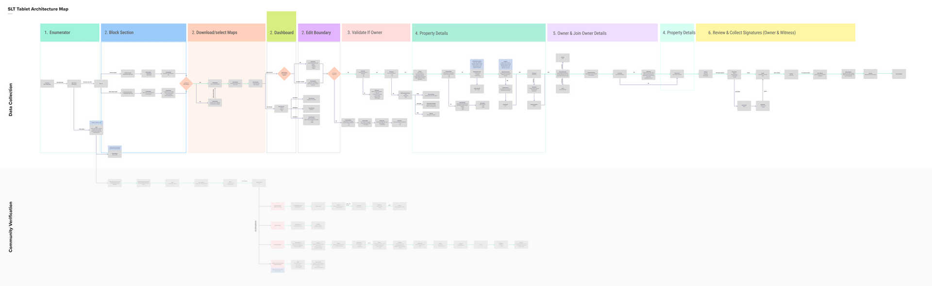
Beta Test - Zambia
SYSTEMATIC LAND TITLING
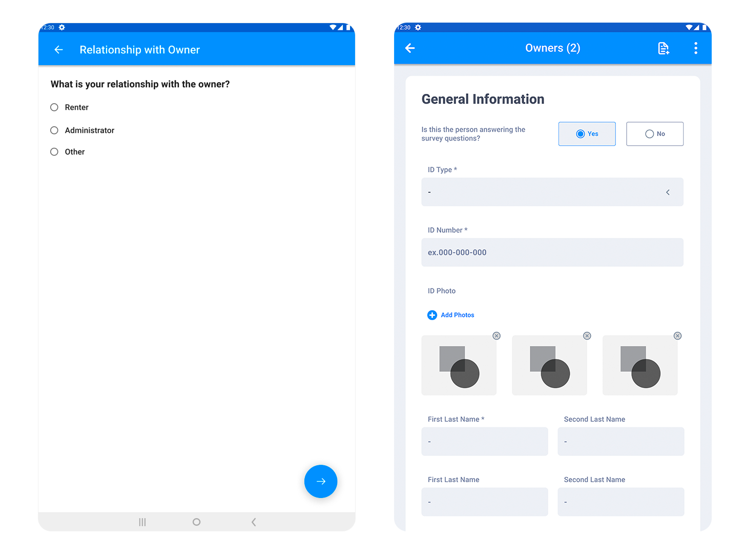
Systematic land titling refers to the process of formally registering and documenting ownership of a piece of land through a systematic and organized method. It involves the creation of a comprehensive land registry system that records all the rights, interests and ownership claims over a piece of land. The objective of systematic land titling is to improve the security of tenure for landholders, increase transparency and accountability in the land ownership process and prevent disputes over ownership.
The process of systematic land titling typically includes the following steps:
- Surveying and mapping of the land – This involves determining the boundaries of the land, its location and its size.
- Title verification – This involves verifying the ownership of the land and ensuring that it is free from any claims or encumbrances.
- Documentation – This involves recording the ownership and rights of the land in a comprehensive land registry system.
- Issuing title certificates – This involves issuing a formal certificate of ownership to the landholder, which serves as proof of ownership.
- Maintenance of the land registry system – This involves updating the land registry system regularly and ensuring that it remains accurate and up-to-date.
Overall, systematic land titling is a key tool for improving land governance and enhancing the security of tenure for landholders. It can also help to increase investment in land, boost economic growth and reduce poverty.
The Challenge
Lack of accurate information: In many countries, land information is often incomplete, outdated, or inaccurate, which can make it difficult to establish clear title to land.
The Hope
To overcome these challenges, it is important to approach systemic land titling as a comprehensive and integrated process that involves the active participation of all stakeholders and is based on a sound legal framework, clear and transparent processes, and the use of appropriate technology.
OUR PROCESS
MLG | Systematic Land Titling